Sleepless in Singapore

My Indian Ocean adventure has begun! I left my house at 6:30am on Saturday morning (after only 4 hours of sleep because of the awesome David Crowder Band concert in Denver the night before, which I’ll post about at some point). Tim picked me up and dropped me off at an RTD bus stop on the Boulder-DIA route — I have an RTD pass so it only costs me $5, which is a sweet deal. There was another NCAR guy on the bus to the airport, so it was good to have some conversation.

While waiting at my gate at Denver I gave my parents a farewell phone call, booked my flights home for Christmas on Southwest, and then my first flight to San Francisco left about 10am. On that flight I chatted with a guy who works for a company in Boulder that makes LIDARs (including for NCAR). He grew up in Eau Claire, is a huge Badger fan, and proudly told me how much he and all Wisconsin fans hate Penn State and our “88-year old troll of a coach.” And then he went on a rant about how much he hates Nebraska and how he hopes they don’t win a Big Ten title for at least 15 years, haha. Methinks he doesn’t like change in the Big Ten! On another note, the Flatirons and Rockies were beautiful to fly over. I could see my neighborhood in Gunbarrel too!

20111014-OfficeWhiteboard.jpg
20111015-ContinentalDivide.jpg

In San Francisco I had barely enough time to snarf down some lunch (figured I’d better take advantage of my last chance to get good Mexican food for six weeks!) before it was time to board our 1pm flight to Hong Kong. Mechanical problems of some sort (a valve needed to be replaced?) forced us back to the gate for awhile, so we took off about an hour and a half late. On that flight I sat next to a guy originally from New Zealand but currently from New Orleans, who was on his way to a marine shipping conference in Singapore. We chatted quite a bit about global warming and the politics of all that, and also the relationship between science and religion, even though he wasn’t a Christian. He was a cool guy. I also managed to get a bit of sleep scattered throughout the 13+ hour flight.

I have decided that I much prefer flying Qantas for trans-Pacific flights than United. On Qantas each seat has its own screen, so you can choose what you want to watch, whereas United has one single viewing option at a time in the economy cabin, and most of it was crap. I also think Qantas is a touch more spacious, with slightly larger seats and slightly more leg room. I could be imagining things though.

20111015-United-747.jpg
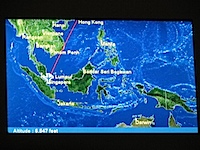
20111017-AlmostToSingapore.jpg

Because of our 1.5-hr delay in San Francisco, we landed late in Hong Kong and had to go straight to board our flight to Singapore. Interestingly we had to go through another two security checks (including one metal detector) before being allowed onto the Singapore flight. The checks weren’t quite as stringent as the ones in the U.S. (didn’t have to take off my shoes, for instance), but my guess is that Singapore has tighter security than many other countries that have flights to Hong Kong (or maybe even HKG itself), and so wanted that extra security for inbound flights. (Or at least that was my guess until I went through security this morning, when I didn’t even have to walk through a metal detector!) That flight left a half hour late despite everyone boarding in time. It was also a 747, just like the SFO-HKG flight, and I had the same exact seat. I really felt like I had just done that…

So we landed at Singapore at about 12:15am this morning (Monday the 17th). After going through immigration and claiming my bag, I asked around where the “nap rooms” were that I’d read about (Lonely Planet advertised nap rooms in the airport that you could rent for up to 6 hrs for just S$40). Apparently the nap rooms are back behind security, and I needed a boarding pass to get back there. Of course since it was now 1am, the Qantas desk was closed. So I found a “viewing gallery” that had some rows of chairs set up. I tried to sleep from 1:30am to about 4:30am, but those chairs were not comfortable to lay on. Maybe I briefly fell asleep once or twice?? Eventually I gave up and went downstairs to wait for the Qantas ticket desk to open up, which it did at 6:30am.

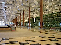
20111017-ChangiAirport.jpg
20111017-SleepingBench.jpg

I should just add here that Singapore’s Changi Airport is by far the nicest airport I’ve ever been in. It really is luxurious. There are plenty of free lounges everywhere, it’s incredibly spacious, very clean, and even the bathrooms are awesome. Also, once I got through security this morning I was immediately approached by an airport staffperson asking if I needed anything. I asked where the free internet kiosk was, and the woman gave me the username and password so that I could get on with my own laptop, instead of having to use the free computers. (Hence I could post this!)

Anyway, now it’s been 35.5 hours since I left my house, and in that time I’ve gotten maybe 4-5 hours of sleep. In one hour (9am Singapore time) my Qantas flight to Perth is scheduled to take off. After that 5+ hour flight, I’ll finally be DONE with airports and planes for a few days! I can’t wait! And I can’t wait to be back in Australia again! I’ll try to post at least once while I’m in Perth visiting Bob. Until next time…

Posted in Travel | Tagged , | 4 Comments

September Shenanigans

My, time is flying. September has come and gone, and now it’s only one more week until I depart for my Indian Ocean adventure. I expect I’ll try to blog a bit more while traveling, especially while I’m on Diego Garcia (though photos might be sparse because of the slow internet connection). Here’s a very brief recap of some of what I’ve been up to the last five weeks.

Air Force Academy

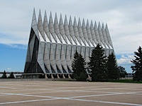
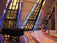
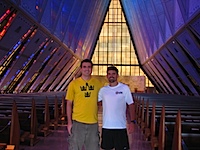
Back in late August I took a day trip down to Colorado Springs to visit my friend Josh from high school, and his brother Justin. Josh gave me a tour of the U.S. Air Force Academy campus, which was pretty neat, especially since Josh is an AFA alum. The AFA Chapel was the highlight, as it’s such an iconic building. A very beautiful one inside, too. After dinner I played some Catan with Josh, Justin, and one of their friends. I’m glad I made it down there when I did, because now Josh and his wife Erika are moving back to Minnesota.

20110827-AirForceChapel.jpg
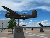
20110827-B24Liberator.jpg
20110827-ChapelPiano.jpg
20110827-JaredJosh-AFAChapel.jpg

Camping Trip and Hot Springs

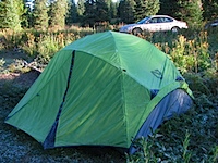
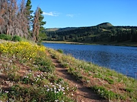
Eager to use my pricey new tent at least once this year, I organized a camping trip up near Steamboat Springs on Labor Day weekend with a few friends. I wanted to get away from the Front Range, so that’s part of why I chose the Steamboat area. With it being the Sunday of Labor Day weekend, I was kind of nervous about finding a campsite since we didn’t have reservations anywhere. But lo and behold, we found a great spot at the first campground we visited, at Dumont Lake (9520 feet) right below Rabbit Ears Mountain — I’d argue it was even the best spot in the whole place.

After setting up our tents we drove up to Steamboat Springs to enjoy the Strawberry Park Hot Springs under the stars. We saw quite a few meteors, which was sweet. I’d been to those hot springs once before, last summer with Alex, but it’s a totally different experience at night. It’s a neat place, and the hot springs felt great on what would become a very frosty night.

It didn’t work out to camp any more the rest of this year, but I definitely plan to camp more often next year.

20110905-FrostyTent.jpg
20110905-DumontLakePathWildflowers.jpg
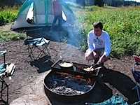
20110905-ChefJared.jpg
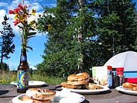
20110905-CampBreakfast.jpg

Hotdish Party

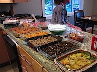
Yah sure, you betcha, I hosted a Minnesota hotdish party at my house a couple weeks ago! I encouraged people to wear flannel, rented the movie “A Prairie Home Companion,” and bought a copy of the book “How to Talk Minnesotan” to give away to the winner of “best hotdish.” There were a couple au gratin hotdishes, a couple tater tot hotdishes, a chicken alfredo hotdish, my beef & wild rice hotdish, a pumpkin bake, a [jello] salad, fruit salad, and a rice & beans salad. The party was a success, people loved it!

20110924-HotdishLineup.jpg
20110924-LisaArtAshleyPeter-DishingUp.jpg
20110924-PlateOfHotdishes.jpg
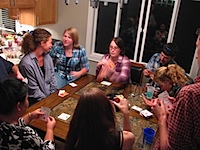
20110924-ApplesToApples.jpg

My 28th Birthday

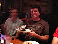
For my 28th birthday last week a few friends joined me at C.B. & Potts for dinner. I definitely worked off my 4.1-mile run from that morning, with appetizers of buffalo wings, cheese dip, an entree of a “bacon-bacon-bacon” burger (with hickory smoked bacon, something called “chicken-fried bacon”, and chipotle bacon mayo, I just had to get it!), a free birthday ice cream cupake, and a good amount of tasty microbrew!

20110927-RichardJared-BirthdayCupcake.jpg
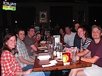
20110927-BirthdayDinner.jpg

Weekend in Ann Arbor

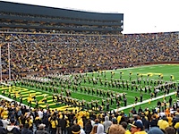
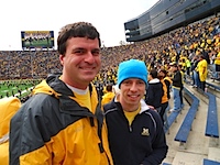
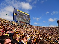
Last weekend I flew to Michigan to go visit Alex. It was a very enjoyable weekend, as it always is hanging out with him. Among other things, Alex got us to the Minnesota-Michigan football game, which was a 58-0 curb-stomping for the Wolverines. Because Penn State wasn’t playing I could just sit back (or stand, since we were in the student section) and enjoy the game. Also because PSU wasn’t playing, I wore a Michigan shirt to the game to fit in. I didn’t want to get assaulted for a second time at Michigan Stadium, haha.

Another highlight of the weekend came when Alex & Anne took me rock climbing. I’d been rock climbing a couple times in the past year or so (once with Alex last year in Colorado, once outdoors this spring in Moab), but I hadn’t successfully made it to the top of a climb. This time I made it to the top of all three climbs I tried! The last two took a lot of perseverance, but I eventually made it to the top. I feel like I accomplished something, and now I’m more likely to try rock climbing again.

Also, every time I hang out with Alex I get motivation to learn how to play guitar. Maybe when I get back from Diego I’ll buy myself a guitar…

20110930-AlexMatt-Shpongle.jpg
20111001-BlockM.jpg
20111001-JaredAlex-MichiganGame.jpg
20111001-Scoreboard-BlueSky.jpg

It’s going to be a busy week coming up, getting ready for my departure to Singapore and Perth, and a week after that, to Diego Garcia! Looking forward to my overseas adventures!

Posted in Food | Tagged , , , , , , , | Leave a comment

Eliminate the National Weather Service??

A few days ago an op-ed appeared on FoxNews.com by a couple people from the Competitive Enterprise Institute, entitled, “Do We Really Need a National Weather Service?” I think it’s one of the more poorly-reasoned op-eds I’ve seen in quite some time. I’ll reproduce the op-ed here in italics, but interspersed with my own comments, Fire Joe Morgan-style. So here we go.

As Hurricane Irene bears down on the East Coast, news stations bombard our televisions with constant updates from the National Hurricane Center. 

While Americans ought to prepare for the coming storm, federal dollars need not subsidize their preparations.

 
Providing weather forecasts for free is not the same thing as subsidizing storm preparations. If the NWS was buying plywood, bottled water, generators, or gas for the public, that would be subsidizing storm preparations.

Although it might sound outrageous, the truth is that the National Hurricane Center [NHC] and its parent agency, the National Weather Service [NWS], are relics from America’s past that have actually outlived their usefulness.

O RLY? This should be interesting.

The National Weather Service (NWS) was founded in 1870. Originally, the NWS was not a public information agency. It was a national security agency and placed under the Department of War. The Service’s national security function has long since disappeared, but as agencies often do, however, it stuck around and managed to increase its budget.

Apparently agencies should not adapt to changing user needs. The first name of the NWS, even when it was in the Department of War (which is now the Department of Defense), was “The Division of Telegrams and Reports for the Benefit of Commerce.” Clearly it was founded with the intent of benefitting commerce and private citizens. It was only in the Department of War because they wanted observations taken regularly, and the military was reliable with routine. By 1890 the Weather Bureau was moved to the Department of Agriculture, and in 1940 it was moved to the Department of Commerce, where it remains to this day (it was renamed the National Weather Service in 1967).

Today the NWS justifies itself on public interest grounds.

The NWS has been serving the public interest for almost their entire history.

It issues severe weather advisories and hijacks local radio and television stations to get the message out. It presumes that citizens do not pay attention to the weather and so it must force important, perhaps lifesaving, information upon them.

How dare these evil meteorologists advise people that a deadly tornado or flash flood is bearing down on their town! What nerve!

A few seconds’ thought reveals how silly this is.

Ummm… What?

The weather might be the subject people care most about on a daily basis. There is a very successful private TV channel dedicated to it, 24 hours a day, as well as any number of phone and PC apps. Americans need not be forced to turn over part of their earnings to support weather reporting.

And guess where almost ALL the information that all these private weather companies comes from? That’s right, the National Weather Service! The NWS (and its parent organization NOAA, the National Oceanic and Atmospheric Administration) is mandated by law to provide all its data to the public for FREE. That includes in situ observations like the surface observation network, radiosondes (weather balloons), dropsondes, and aircraft observations. It includes remotely sensed observations from a host of multi-million-dollar satellites that observe the entire globe. It also includes data from numerical weather prediction (NWP) models, and ensembles of these NWP models (and I can tell you from personal experience with my research and experience that NWP ensembles are incredibly expensive to run in terms of computing power). If private companies had to build and maintain all this on their own, there wouldn’t be any such thing as free public forecast data.

Also, the annual budget of the NWS is currently about $1 billion. That works out to about $3/year per person. I think everyone nationwide gets more than $3/year of benefit out of the NWS. I think we get more bang for our buck from the NWS than we do from almost any other government agency.

The NWS claims that it supports industries like aviation and shipping, but if they provide a valuable contribution to business, it stands to reason business would willingly support their services. If that is the case, the Service is just corporate welfare. If they would not, it is just a waste.

Many private companies do sell their forecast products to businesses, if the businesses decide they want products that are more specialized to their needs than the free information they can already obtain from the NWS. There is a tremendous market for niche specialization of forecasts. The NWS does not cater its forecast products to each specific users’ needs for a reason, and that’s because it’s outside the scope of its mission. The NWS is not corporate welfare.

As for hurricanes, the insurance industry has a compelling interest in understanding them. In a world without a National Weather Service, the insurance industry would probably have sponsored something very like the National Hurricane Center at one or more universities. Those replacements would also not be exploited for political purposes.

Are you kidding me?!? Do these people want to admit they have no critical thinking skills? The insurance industry is only interested in hurricane climatologies, not in better forecasting any individual storm. They’d try to guess at the total number of tropical storms and hurricanes over the course of the season, but that’s about it. Being able to forecast the track or intensity of an individual storm would not do anything to help mitigate their losses or increase their profits. The only way it would is if they allowed people to buy hurricane insurance when it becomes clear a hurricane’s heading their way, but then it wouldn’t be insurance. (You can’t buy homeowners insurance if a forest fire is bearing down on your property, and you can’t buy health insurance after you get sick and expect to be covered — oh wait, Obamacare redefined the meaning of health “insurance,” but that’s a whole ‘nother post.)

For Hurricane Irene, the NHC’s track forecast was excellent. Five days out they predicted landfall somewhere near the NC/SC border, and by one day out their track error was down to 10 miles. That’s phenomenal. 20-30 years ago, the typical one-day track error was what the five-day track error was with Irene last week. Their intensity forecast was a bit off, but hurricane intensity has been a bugaboo for decades because there are still great mysteries with hurricanes that we haven’t yet figured out. The reason why a stronger hurricane was predicted was that the hurricane looked like it was going through another eyewall replacement cycle a day or two before landfall, except a new eyewall never formed. We don’t know why. Many good scientists have been and continue to research this area, but more funding is necessary before we’ll unlock the secret to making good intensity forecasts (and figuring out how to predict eyewall replacement cycles is a huge part of that).

As it stands today, the public is forced to pay more than $1 billion per year for the NWS.  With the federal deficit exceeding a trillion dollars, the NWS is easily overlooked, but it shouldn’t be.

True, the government spends way, WAY too much money. The government has a huge spending problem. I think that government spending ought to return to about the long-term normal 18-20% of GDP from the 25% that it’s skyrocketed to under President Obama (it was about 21% or 22% of GDP when he took office). But that doesn’t mean that everything should be cut. I think that every single government expenditure ought to be rated on a scale ranging from “vital” to “important” to “useful” to “luxury/unnecessary” to “waste” (or similar). On such a scale, I would place the NWS somewhere on the “vital” part of the scale. The NWS is one of the LAST agencies that should be up for drastic cuts or elimination.

It may actually be dangerous.

You know what else can be dangerous? Faulty reasoning fueling incendiary rhetoric by people who don’t have a clue what they’re talking about.

Relying on inaccurate government reports can endanger lives. Last year the Service failed to predict major flooding in Nashville because it miscalculated the rate at which water was releasing from dams there. The NWS continued to rely on bad information, even after forecasters knew the data were inaccurate. The flooding resulted in 22 deaths.

It doesn’t matter if the report comes from government or private agencies, inaccurate forecasts can result in people not getting themselves out of harm’s way. As every single weather forecaster will tell you, everyone has busted forecasts from time to time. Less skilled forecasters have busted forecasts more frequently.

As for the Nashville flooding, the bad data came from the U.S. Army Corps of Engineers. Check out the actual NWS internal report, or a more informative newspaper article than the one CEI linked to in their story. The NWS absolutely screwed up, as their report indicates. But a lot of the blame also lies at the feet of the U.S. Army CoE. Everyone has busted forecasts and makes mistakes, but this one unfortunately probably contributed to a few deaths. NWS is learning from this terrible mistake and correcting their procedures, you can be assured of that.

Furthermore, would any private company want the responsibility of issuing public severe weather watches, warnings, and advisories? There would be huge liability issues there. Also, would we have ten different companies each issuing their own competing warnings? Would there need to be legislation mandating that one company be in charge of warnings?

NWS has vastly improved warning times for tornadic thunderstorms, so that now the average warning time for a tornado is about 20 minutes. That’s phenomenal, and it’s going to be hard to do much better than that until we know why some thunderstorms become tornadic and why others don’t. People are working on that, but we need more research dollars for that.

Private weather services do exist, and unsurprisingly, they are better than the NWS. When Hurricane Katrina hit New Orleans in 2005, the National Weather Service was twelve hours behind AccuWeather in predicting that New Orleans would be affected.

One case of AccuWeather being 12 hours quicker in predicting that a hurricane would hit New Orleans doesn’t make their case that NWS sucks at forecasting hurricanes. You can’t prove anything from one data point. Statistics FAIL. AccuWeather is also known for breathlessly overhyping countless storms, either into a monster category 5 roaring up the east coast, or into the blizzard of the century. Joe Bastardi was particularly guilty of this while he worked at AccuWeather. There’s a reason why my friends from Penn State and I call their forecasts “AccuMongering.”

[UPDATE at 8:45am MDT on 1 Sep 2011: I found another site that compares the NWS and AccuWeather forecasts for Hurricane Katrina. Looks to me like NWS had a far better forecast three days in advance of Katrina’s landfall on the Mississippi coast.]

Unlike the NWS, AccuWeather provides precise hour-by-hour storm predictions, one of the reasons private industry supports them.

Yes, some industries require hourly forecasts, such as the energy sector. That’s why NCAR (where I work) is under contract to help build a good wind forecasting system for Xcel Energy currently, for instance. Right or wrong forecasts for a single event can lead to savings or costs of millions of dollars. It’s big business. But the NWS doesn’t issue hourly forecasts because most of the public doesn’t need it. When companies want it, they pay for a source that will provide them with such info if it proves beneficial to them.

It is not just random mistakes in crises either. Forecast Watch has found that the National Weather Service predictions of snow and rain have an error rate 20 percent higher than their private alternatives. “All private forecasting companies did much better than the National Weather Service,” their report concludes.

What the CEI authors didn’t disclose was that the Forecast Watch study compared NWS to only three private companies: The Weather Channel, DTN Meteorologix, and CustomWeather, so saying that NWS is poorer than “all” private companies is an overstatement. Also, the study was done over just a nine-month period, Oct 2006-Jun 2007. There is value in this study, to be sure, but it would be better to do these comparisons at least over an entire calendar year, and preferably more than one year. It would also be interesting to find out if certain WFOs (weather forecast offices) in the NWS were better than others at predicting probability of precipitation, and if there were any regions in which NWS outperformed those private companies. NWS certainly has room to improve in predicting probabilities of precipitation, however, as does everyone.

In 2008, they found that the NWS’s temperature predictions were worse than every private-sector competitor including the Weather Channel, Intellicast, and Weather Underground.

The CEI authors did not link to an actual study, so I can’t evaluate their claim. I will note, however, that the extended forecast product for Weather Underground is the verbatim NWS zone forecast. If NWS sucked, then why is Weather Underground using NWS forecasts? Also, The Weather Channel so frequently had terrible temperature forecasts by relying on MOS that my Penn State friends and I called it “The Weather Channel Slot Machine.”

Even NWS’s online ZIP code search for weather reports is in some cases totally inaccurate, giving reports for areas hundreds of miles away.

No examples were given. I have never encountered this problem, for what it’s worth. I haven’t even heard of this problem before, so I really wish they would’ve given concrete examples.

NWS claims to spread information, but when the topic of budget cuts came up earlier this year, all they spread was fear. “There is a very heightened risk for loss of life if these cuts go through,” NWS forecasters said, “The inability for warnings to be disseminated to the public, whether due to staffing inadequacies, radar maintenance problems or weather radio transmitter difficulties, would be disastrous.”

I happen to agree with NWS here. One of the contributing factors to the blown forecasts of the Nashville floods (which CEI brought up earlier) was that the forecasters were overwhelmed. Fewer staff and fewer resources will help prevent history from repeating itself?

Disastrous? The $126 million in cuts would still have left the Service with a larger budget than it had a decade ago.

How about in inflation-adjusted dollars? Also, there are more observing networks to maintain, and more expensive modeling systems to run. Sure, we could go back to the models of a decade ago, but the public would not like the resultant degradation in forecast skill. The private sector wouldn’t, either, because the quality of their forecasts is dependent on that NWS data.

The massive bloat in government should not get a pass just because it’s wrapped in good-of-the-community clothing.

The authors haven’t done anything to show that there’s massive bloat in NWS. That would’ve required actual examination of the NWS budget items.

NWS services can and are better provided by the private sector.

Except that the private sector relies almost entirely on the free data and services provided by the NWS and other governmental agencies from around the world.

Americans will invest in weather forecasting because if there is one thing we can be certain of, people will want to protect their property and their lives.

And that’s exactly why NWS exists and why our government invests in it, to protect life and property! Argh!

In closing, the authors might be worth listening to if they actually made a good argument that didn’t rely on misrepresentation of facts, omission of facts, or ridiculous arguments. When they can’t even treat their argument knowledgeably or honestly, they deserve to be exposed for it. I’m not saying this just because it’s “close to home” as a meteorologist. But because it’s “close to home” I can show their arguments to be downright silly. For an additional take on it, check out this article from another PhD meteorologist.

Posted in Uncategorized | Tagged , , , | Leave a comment

Three Years

Today was a hard day. Today marks three years since my brother Aaron was killed in a jet ski accident. It’s been three years, but I still miss Aaron terribly. I can take comfort that he was a strong Christian, though, so I will see him again in heaven. It’s good to remember the words that my Dad read at his funeral, a personalization of Ephesians 1:3-14:

“Blessed be the God and Father of our Lord Jesus Christ, who has blessed Aaron in Christ with every spiritual blessing in the heavenly places, even as He chose Aaron in Him before the foundation of the world, that Aaron should be holy and blameless before Him. In love He predestined Aaron for adoption as a son through Jesus Christ, according to the purpose of His will, to the praise of His glorious grace, with which He has blessed Aaron in the Beloved. In Him Aaron has redemption through His blood, the forgiveness of our trespasses, according to the riches of His grace, which He lavished upon Aaron, in all wisdom and insight making known to Aaron the mystery of His will, according to His purpose, which He set forth in Christ as a plan for the fullness of time, to unite all things in Him, things in heaven and things on earth.

In Him Aaron has obtained an inheritance, having been predestined according to the purpose of Him who works all things according to the counsel of His will, so that we who were the first to hope in Christ might be to the praise of His glory. In Him Aaron also, when Aaron heard the word of truth, the gospel of his salvation, and believed in Him, was sealed with the promised Holy Spirit, who is the guarantee of Aaron’s inheritance until Aaron acquires possession of it, to the praise of His glory.”

And also, the words of Aaron’s favorite hymn, “Immortal, Invisible, God Only Wise,” bring comfort.

I remember when I was deciding whether to go to grad school at CU-Boulder or Penn State, Aaron told me that if I chose Colorado, he’d come visit me for sure because he & Eve already wanted to take a vacation to Colorado. And now I find myself living in Colorado, but he won’t be able to come visit me. That’s come to mind many times in the last year.

Please keep our whole family, but especially Aaron’s wife Eve and their kids Ella and Matthias in your prayers. Miss you, Aaron.

Posted in Uncategorized | Tagged | Leave a comment

August Adventures

It’s been almost a month since I’ve blogged, but there’s good reason. August has been a very fun month so far, with friends visiting, more hiking in Rocky Mountain NP, climbing three 14ers, and even attending a concert at Red Rocks! And last weekend I didn’t even do anything. 🙂

Halls and the Rockies

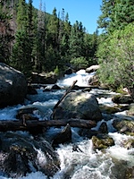
At the beginning of the month Ryan & Sarah Hall came through Colorado at the end of their nearly four-week west coast road trip from Chicago. On Sunday the 31st (of July) we went hiking in the Wild Basin area of Rocky Mountain National Park. The trail we took followed North Saint Vrain Creek past Copeland Falls, the Calypso Cascades, and Ouzel Falls. It was nice to hear running water and waterfalls through most of the hike!

20110731-CopelandFalls-NorthStVrainCreek.jpg
20110731-RyanSarahJared-OuzelFalls.jpg

And then the following night I joined them at Coors Field for the Phillies-Rockies game. It’s neat when you can see the mountains from your seat! We were one row below the “purple row” in the upper deck (row 20), which is at elevation 5,280 feet. There were a lot of Phillies fans at the game, and I even saw one girl with a green “State Patty’s Day” shirt on (ugh). Phillies fans were making themselves heard, by (of course) lustily booing every time the Rockies catcher went out to the mound to talk to the pitcher. It was an entertaining game too, but unfortunately for the Rockies, a Phillies pinch-hitter tied the game on a home run with two out in the top of the 9th, and then another home run in the 10th won it for the red-hot Phillies, 4-3. Anyway, it was great to see Ryan & Sarah again!

20110801-SarahRyanJared-CoorsField.jpg
20110801-HomeRunFountains-Sunset.jpg

Mount Bierstadt – 14er #1

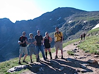
On Saturday the 6th I checked off an item from my “Colorado bucket list”: I hiked up a 14er! Five of us (me, Amy, Tim, Richard, Richard’s friend Anthony) got up really early in the morning to go hike Mt Bierstadt. Mt Bierstadt is rated as the easiest 14er to climb, but that doesn’t mean it’s an easy hike.

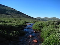
The hike started at Guanella Pass (11,669 feet), a few miles away from Georgetown, CO. The trail dips down about 200 feet to Scott Gomer Creek before rising all the rest of the way to the summit at 14,060 feet. I have to say it’s kind of annoying to start a hike up a 14er by going downhill for awhile — because that means the end of the hike is uphill as well. Anyway, I was trucking along until about 13,000 feet, when the trail became much steeper. I started lagging the rest of the way up to the top, but I made it!

20110806-HikingToMtBierstadt.jpg
20110806-ScottGomerCreek.jpg
20110806-RichardAnthonyTimAmyJared-MtBierstadt.jpg
20110806-BierstadtSummit.jpg

It was pretty chilly up at the summit, about 40-45 degrees and quite windy. But the view from the top of Mt Bierstadt (14,060 feet) was spectacular! Here’s a video from the summit:

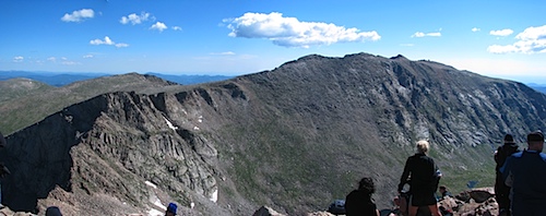
Here’s the view looking west (in the very center of the photo are two neighboring peaks, Grays Peak (14,270 feet) and Torreys Peak (14,267 feet)):

20110806-pan-BierstadtSummitView-LookingWest.jpg

And here’s the view looking northeast, toward the nearby Mt Evans (14,264 feet):

20110806-pan-BierstadtSummitView-Northeast.jpg

My first 14er! It was exhilarating!

20110806-AmyTimRichardAnthonyJared-AtopMtBierstadt.jpg
20110806-Jared-AtopMtBierstadt.jpg

Here’s a final look at Mt Bierstadt from the trailhead, at the conclusion of our hike (to the left of Mt Bierstadt is The Sawtooth, the narrow, exposed path over to Mt Evans):

20110806-pan-MountBierstadt.jpg

Concert at Red Rocks

Another item on my Colorado bucket list was attending a concert at Red Rocks Amphitheatre just west of Denver. At the beginning of the summer I looked up their concert schedule, and had the 12th of August circled for a concert with The John Butler Trio. Unfortunately I couldn’t convince any friends to join me (concerts are expensive after all), so I wound up going by myself. I wanted to buy a ticket in advance, but Ticketmaster had an outrageous extortion fee — they were charging $55 for a $38.50 ticket. So instead I showed up at the box office on the day of the show, and got one for $40. Denying Ticketmaster their extortion fee is definitely a win.

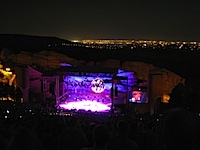
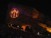
At any rate, Red Rocks Amphitheatre is an amazing concert venue, sitting between Ship Rock and Creation Rock, with the city of Denver visible a few miles beyond the stage. It was a perfect Colorado evening too, with temps in the upper 70s and a full moon rising. The concert itself was pretty awesome too, and The John Butler Trio played for over two and a half hours! The concert obviously would’ve been more fun with some friends, but I still enjoyed it quite a bit. I left at the start of the final encore song so that I wouldn’t be trapped in the parking lot forever, especially since I had to wake up in a few short hours to go hiking.

20110812-Jared-RedRocks.jpg
20110812-JohnButlerTrioArrows-ShipRock.jpg
20110812-JohnButlerTrioConcert-DenverLights.jpg
20110812-CreationRock-RedRocksAmphitheatre.jpg

Grays & Torreys Peaks (14ers #2 and #3)

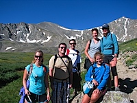
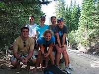
After three hours of sleep following the concert at Red Rocks (which included five hours of sitting on a bench without a seat-back), it was time to wake up to go climb two 14ers! This time it was me, Richard, Amy, and three of the Moxness sisters (Adelle, Melanie, and Mikaela), all friends from church.

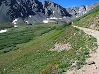
First off, the road from I-70 up to the Grays Peak trailhead is TERRIBLE. I’d really only advise going up there with a 4WD vehicle. Even so, you can only go about 3 mph because it’s so ridiculously bumpy and unmaintained. Partway up the narrow, steep road we saw a bunch of cars parked along the side, so figured we’d better park too. A guy even said, “Oh yeah, the trailhead’s right here.” So we got out our stuff and started hiking up the steep road. A mile and a half later we finally came to the trailhead. Ugh. I think we might’ve done 800-1000 feet of climb in that 1.5 miles. I’m tellin’ ya, that road was relentlessly steep. And oh yeah, there was still some parking at the lot at the trailhead. So we were already a bit tired by the time we got to the actual start of the trail at 11,280 feet.

20110813-TrailsideWildflowers.jpg
20110813-AmyJaredRichardAdelleMelanieMikaela-GraysAndTorreys.jpg

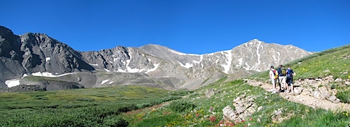
A bit over a mile into the hike, at elevation 12,100 feet, here’s a view of Grays Peak (14,270 feet, on the left) and Torreys Peak (14,267 feet, on the right). It looks like Torreys is taller, but it’s not. Grays Peak also happens to be the tallest peak along the Continental Divide, and the tallest in the Front Range.

20110813-pan-GraysAndTorreys.jpg

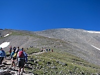
The hike to the top of Grays and Torryes was noticeably more arduous than the hike up Mt Bierstadt, but it’s still among the easier 14er hikes, apparently. It’s just a longer, steeper hike than Bierstadt. There are also so many switchbacks on the trail to Grays that it often feels like you aren’t making progress. Anyway, I was doing well setting the pace until around 13,000 feet again, when I started lagging a bit at the back of the group, just like on Bierstadt. But after a break I decided to take the lead again, and I didn’t have exhaustion problems the rest of the way up, surprisingly. The mind is pretty powerful, even when it’s oxygen-deprived. 🙂 And on the way up Grays Peak I even ran into a fellow Penn State Meteorology alum, Beth R.! We Are… everywhere! At last we made it to the top of Grays!

20110813-Pond-TorreysPeak.jpg
20110813-ClimbingGrays.jpg

Below is a view from Grays Peak, looking west (toward Keystone Ski Resort, Silverthorne, Lake Dillon):

20110813-pan-ViewFromGraysPeak-LookingWest.jpg

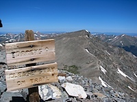
Below is a view from Grays Peak, looking north. From L to R: Torreys Peak (14,267 feet), Kelso Mountain (13,100-something), and Stevens Gulch. Our trail came up Stevens Gulch, winding around Kelso Mountain before scaling Grays.

20110813-pan-ViewFromGraysPeak-LookingNorth.jpg

Below is a view from Grays Peak, looking east. In the center of the photo are two 14ers, Mt Evans (14,264 feet, on the left), and Mt Bierstadt (14,060 feet, on the right).

20110813-pan-ViewFromGraysPeak-LookingEast.jpg

Grays Peak was my second 14er, and I was feeling pretty good!

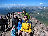
20110813-MikaelaRichardAmyAdelleMelanieJared-GraysPeakSummit.jpg
20110813-Jared-GraysPeakSummit-14erNumber2.jpg
20110813-BethJared.jpg
20110813-Torreys.jpg

After a lunch break, it was time to head down to the Grays-Torreys saddle (13,700 feet), and then climb straight up Torreys. It was steep, and brutal after having taken a break atop Grays. My body did not like going back uphill at this point, especially such a steep hill, and I struggled making it up Torreys. But I did make it, and that wasn’t ever in question.

20110813-GoingUpTorreys.jpg
20110813-JaredRichardAdelleMelanieAmyMikaela-TorreysPeak.jpg

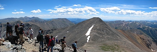
Here’s a view from Torreys Peak, southeast toward Mt Evans, Mt Bierstadt, and Grays Peak (notice all the switchbacks on Grays!):

20110813-pan-ViewFromTorreysPeak-LookingEast.jpg

14er number three, and the second of the day!

20110813-Jared-TorreysPeak-14erNumber3.jpg
20110813-CheckingOutAlternateWayDown.jpg

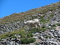
I ran out of water before I made it to the top of Torreys Peak (I had 3 liters in my Camelbak), leaving me with about 2/3 of a liter of Powerade to ration on the 3.5-hr hike back down. Highlights of the way down: several snowballs suddenly whizzing by my head, mountain goats, wishing my legs weren’t horribly sunburned (I forgot to put sunscreen on them, sigh), and putting on flip-flops when we were finally done.

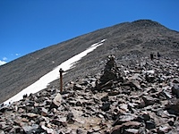
20110813-TurnoffForTrailDown.jpg
20110813-AmyAdelleMelanieMikaelaRichard-Snowfield.jpg
20110813-MountainGoats.jpg
20110813-MountainGoatOnGrays.jpg
20110813-HeadingDown.jpg
20110813-RichardAmyAdelleMelanieJaredMikaela-FinishLine.jpg

Approx. 12 miles, approx. 4500 feet elevation gain, approx. 10.5 hours, and two 14ers conquered. We were all exhausted and sore, but felt very accomplished!

Posted in Uncategorized | Tagged , , , , , | 3 Comments