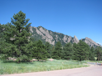
 Colorado is a pretty awesome place. I just wrapped up a full week there, and it was a fantastic week. There were some work-related purposes for the trip, including working with the DART developers at NCAR (National Center for Atmospheric Research) and getting feedback on how I should be using it for my research project. Another purpose was to meet my future supervisor, which I did on Monday morning the 12th. He seems like a nice guy, but it’ll definitely be an adjustment changing supervisors. Sue will still be my co-advisor, however.
In addition to all the work-related stuff for me to do at NCAR (and my visit was useful, I thought), Alex was also at the tail end of a 3-month visit to NCAR when I was there. Bonus! I arrived in Denver on Friday night the 9th, and took the Super Shuttle to Boulder, where I had arranged to rent a bedroom in someone’s house, just a 5-minute walk from NCAR Foothills Lab. Convenient! And it was only about three blocks from where Alex was staying too. Somewhere between the State College and Detroit airports I lost my memory stick, however. It had my presentation and other relevant data files on it, among other things. I called lost and founds at both airports and filed a missing item report with Delta, but nobody had found it or turned it in. Oh well. Fortunately Kerrie was able to go into the Water Tunnel Building to find and email me the files I needed. Thanks, Kerrie!! I would’ve been up a creek without that.
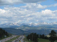
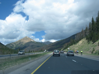
Anyway, Alex had gone with some friends out to Steamboat Springs that evening to catch the hot air balloon festival at dawn on Saturday morning. But he left me his car and keys so that I could drive to Steamboat on Saturday and catch up to him in early afternoon. I’d never been west of Boulder in Colorado, and it was a beautiful drive west from Denver on I-70 to Silverthorne and then up to Steamboat Springs on CO-9 and US-40.
 |
 |

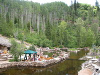
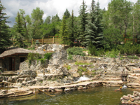
Alex’s friends returned to Boulder about 20 minutes before I got to Steamboat, so when I arrived we went right to nearby
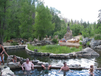
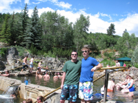
Strawberry Park Hot Springs, where Alex had just been with his other friends. They have natural hot springs there, but also a snowmelt-fed creek, so for the different pools they blend different amounts of each, so each pool is a slightly different temperature. That place was really neat, and well worth the $10 admission.
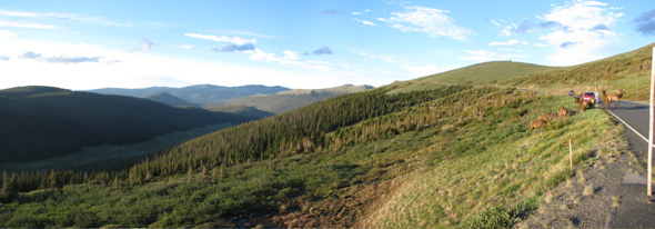
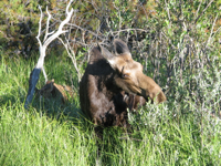
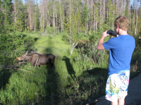
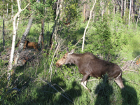
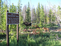
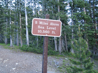
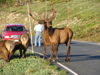
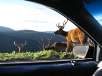
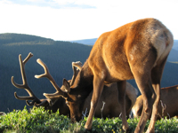
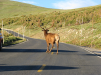
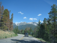
From there, after buying a bunch of food for camping and hiking (way too much food, but at least we were prepared!), it was on to Rocky Mountain National Park, following Trail Ridge Road all the way from the southwest corner of the park to Estes Park. What a spectacular road! Much of the road had a steep drop-off on one or both sides, and Alex said he was a bit nervous driving it, even though we had perfect weather. I’d hate to drive it in fog or snowy/slippery conditions! It also got pretty chilly as we climbed above 2 miles above mean sea level (maxing out at 12,183 feet), as we were still in flip-flops, t-shirts and swim trunks from the hot springs, so I didn’t linger outside when we stopped the car to take pictures. In addition to great views, we also saw a couple of moose (a mother and juvenile), as well as several elk.
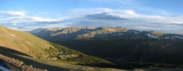
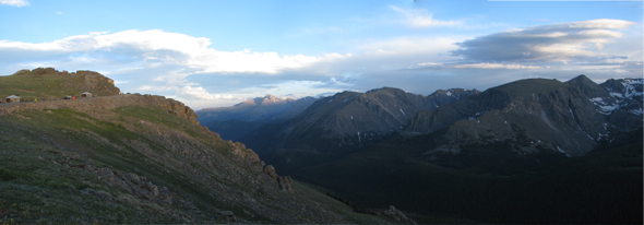
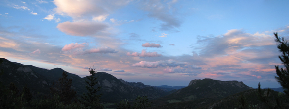
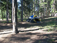
We planned to camp, but the first campsite we went by on the west side of RMNP, Timber Creek, was hideously ugly and looked like a scar in the landscape (hence we got to see most of those great views above). Then we tried Aspenglen, but it was full (and dark). Finally we tried a campground a couple miles south of Longs Peak (14,259 ft), which Alex & Anne camped at a couple weeks prior. Fortunately, at 9:45pm, long after sunset, we found a spot, so we could set up our tent and finally grill our steaks and bread. We were totally roughing it. 🙂 It was my first time camping since Australia in 2004, but the hard ground prevented me from getting too much sleep. So in the span of three nights I’d gone from State College (~1200 feet) to Boulder (~5500 feet) to this campground (~8000 feet) south of Estes Park. So I at least let myself adjust to the altitude a little bit before we did any hiking. 🙂
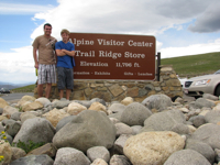
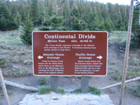
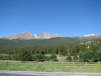
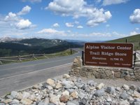
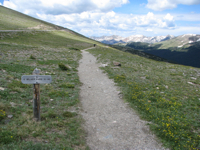
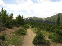
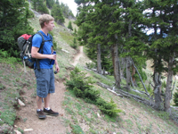
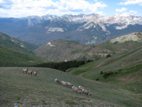
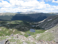
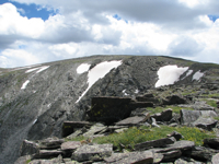
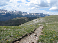
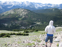
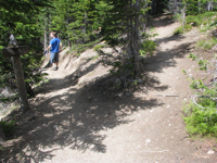
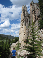
On Sunday morning the 11th we drove back up to the Alpine Visitor Center (11,796 ft) in Rocky Mountain National Park to do some hiking. We hiked along Ute Trail, which started across the road from the Alpine Center, and took turns carrying the backpack. Our map said the trail went 4.1 miles to Milner Pass, where Trail Ridge Road crossed the Continental Divide. Views along the trail were pretty spectacular.
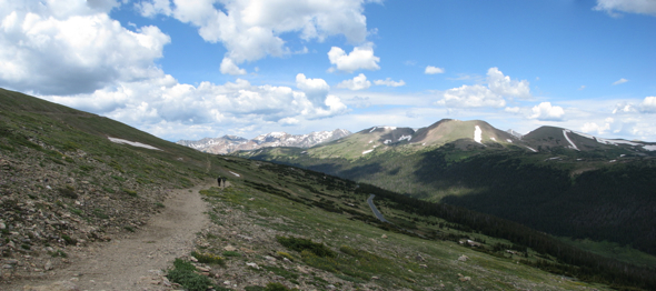
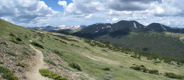

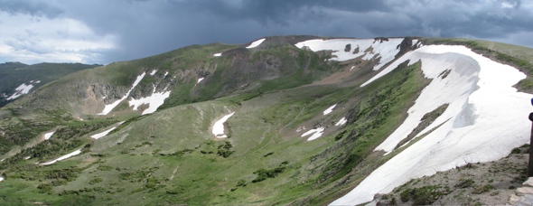
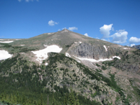
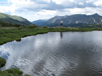
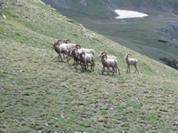
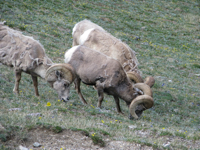
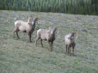
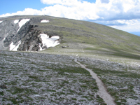
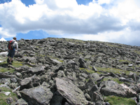
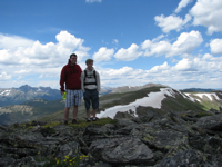
After awhile I started thinking we’d been hiking more than 4 miles, but we just kept going. Eventually we came pretty close to a herd of bighorn sheep too, which was really cool. We later found out that it’s rare for people to see bighorn sheep as close by as we saw them. Occasionally we passed people going the other way. I’d asked one person, “How much farther is it?” “Oh, another hour and a half or so.” Hmmmm. Later, we passed another person. “How far ahead is the [Continental] Divide?” “You’re on the Divide. And that’s Mount Ida over there, about 45 minutes ahead.” I heard what they said, but it just didn’t register. And I hadn’t heard of Mount Ida before, so that meant nothing to me. Anyway, we kept walking. And walking. Above 12,000 feet. Through a steady 20-mph wind battering my senses. I got a little light-headed at one point, but it wasn’t too bad and went away (that was it for me as far as being affected by the altitude). Eventually the trail disappeared amongst a scree of boulders on a mountainside. We kept going a bit further, but then started to strongly suspect that somehow unbeknownst to us we were no longer on Ute Trail. So I got out the map, and my eyes went right to “Mount Ida.” That’s so far off Ute Trail, along the Continental Divide, it suddenly clicked that that’s where we had to be. I asked Alex to look over the ridge and tell me if he saw a couple small lakes. Yep. That’s where we were. Instead of merely walking across the Continental Divide, we’d hiked 3.5 miles along the Continental Divide, at 12,000 feet. We were pretty close to the summit of Mount Ida (12,880 feet), only about a half mile of hiking and about 300 feet of elevation away. But we had no idea what time it was and there were rain clouds approaching from the southwest, so we decided it was wisest to turn around and start walking back.
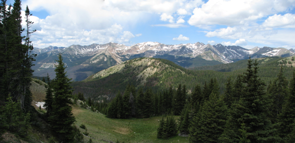
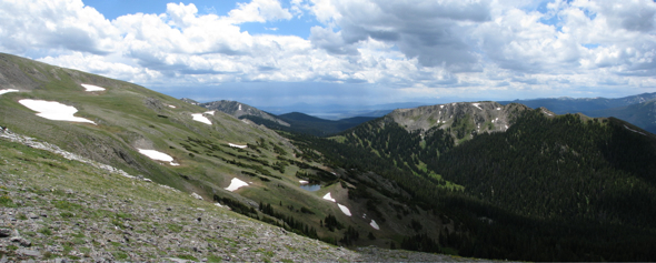

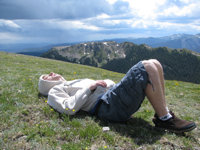
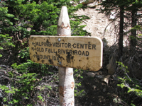
Eventually we found where we left Ute Trail and started down Mount Ida Trail. Coming from Alpine Center, Ute Trail takes a 150-degree turn, and we didn’t see it at all. We saw a sign pointing back to Alpine Center and forward to Mount Ida, but the type on the sign didn’t register with either of us. Neither of us turned around either, otherwise we would’ve seen Ute Trail going down the hill. So instead we kept going straight, and eventually wound up on the slopes of Mount Ida. Anyway, coming back from Mount Ida, we took the fork of Ute Trail that went down to Milner Pass, to complete the hike we originally intended. On our way down to Milner Pass, a guy named Dan, who we’d run into after we turned around near Mt Ida, caught up to us. He said, “You guys are made of metal! Accidentally hiking an additional 7 miles at 12,000 feet and you’re still going strong!” By the time we got down to Milner Pass (10,758 ft) we were exhausted though, having hiked a total of 11 miles. Dan was kind enough to give us a ride 4 miles (and 1000-ft elevation rise) back up the road to Alpine Center and Alex’s car. We certainly could’ve hiked that last 4 miles up the hill, but we were thrilled that we didn’t have to. Neither of us have any regrets about missing the turn, though. It was super-cool and breathtaking to hike for 7 miles along the Continental Divide! Definitely not something too many people get to say that they’ve done.
 |
 |
By the time we got back to our campsite to take down the tent it was 5:30pm. We’d intended to be back for a late lunch and grill our other steaks. Oh well. By then it was late enough that we decided just to pack everything up and go out to eat in Estes Park. We were pretty hungry, because all we had to eat all day were two Twix, two bananas and three granola bars each. (That might be another reason we were so exhausted by the end of our hike!) We found a pizza place, but they said they didn’t have any beer. What they said they could do, though, is to bring our order down to the Irish pub a few doors down the street. Sweet! Let me tell ya, that order of onion rings, pizza and big pitcher of Fat Tire really hit the spot for both of us! Then it was back to Boulder, about 45 minutes from Estes Park. What a day, what a weekend!
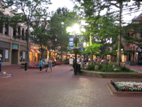
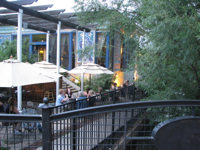
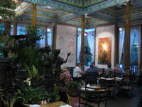
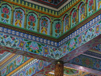
As for the rest of the week, we checked out some other cool places. Monday night was the Boulder Draft House, with a $7 burger and beer special. Any burger on the menu. So we both got their most expensive burger ($12) and Fiesty Fiddler IPA. Yum! On Tuesday night I convinced Alex to try something new — the Boulder Dushanbe Tea House (a Tajik restaurant). Delicious. Thursday for lunch we went to a place called Smash Burger, and then that night we drove up to Lyons to go to Oskar Blues Grill & Brew. Ribs and IPA. Glorious. I’ll tell you what, Colorado has lots of fantastic beer!
 While we did a lot of eating and drinking, we did do more stuff than that. 🙂 One night Alex introduced me to the game Bananagrams, which is basically like simultaneous, real-time Scrabble, except you can constantly rearrange your words to fit in new letters. We fit in a workout early Wednesday morning (I got up at 6am to go run with Alex down to the gym), went to an NCAR picnic Wednesday afternoon (when I helped Dr Greg Holland carry a keg of Fat Tire back up to his vehicle, he said to Alex & me with a smile, “I’m glad to see that grad students still have their priorities straight when it comes to free beer,” lol), played some pickup soccer with a bunch of Alex’s friends from NCAR (we were the only two Americans, interestingly), and went rock climbing that evening. It was my first time climbing since our study abroad orientation in Australia five years ago.
Climbing didn’t go well for me this time though. Whatever physical excuses I might’ve had (tired/sore arms from lifting weights that morning for the first time in a couple months), let’s just say I really need to work to change my attitude when I run into difficulty in a physical activity, be it skiing, running or rock climbing. When it comes to my body, my will is pretty weak, and I have a tendency to get easily frustrated, excessively negative and pouty. It’s not pretty, but it’s something I realize I desperately need to change. I had hoped to redeem myself with another go at climbing on Friday morning, but Alex was too tired (woke up super-early) and had too much to do, with it being his last day at NCAR. My arms were still sore that day anyway, so maybe it was for the best that I’ll wait to try again. Next time, whether I reach the top or not, at the very least I will have a better attitude.
I flew out early on Saturday morning the 17th, and the original plan was for Alex to drop me off at the airport and then continue his long drive eastward to Iowa and then Michigan. But we got home from his farewell party too late Friday night, and he had too much more packing to do, so in order to let him get a bit more sleep before his super-long drive, I took the Super Shuttle to the airport (the shuttle was 45 minutes late though, which didn’t make me happy, as it was supposed to pick me up at 4:30am). I was very close to calling and waking up Alex to ask him for a ride when the shuttle finally arrived. I was glad I didn’t have to because he really needed the sleep with two days of long drives ahead of him.
Overall I had a terrific week in Colorado. It was a useful trip work-wise, and it was fantastic to be able to hang out with Alex for a week. I really enjoyed that. I desperately needed the break, too, after having worked so hard in the six weeks coming into it. I think I’ll be able to get used to living in Colorado starting in November (mountains and low humidity sure are attractive!). Visitors welcome!
 Colorado is a pretty awesome place. I just wrapped up a full week there, and it was a fantastic week. There were some work-related purposes for the trip, including working with the DART developers at NCAR (National Center for Atmospheric Research) and getting feedback on how I should be using it for my research project. Another purpose was to meet my future supervisor, which I did on Monday morning the 12th. He seems like a nice guy, but it’ll definitely be an adjustment changing supervisors. Sue will still be my co-advisor, however.












 While we did a lot of eating and drinking, we did do more stuff than that. 🙂 One night Alex introduced me to the game Bananagrams, which is basically like simultaneous, real-time Scrabble, except you can constantly rearrange your words to fit in new letters. We fit in a workout early Wednesday morning (I got up at 6am to go run with Alex down to the gym), went to an NCAR picnic Wednesday afternoon (when I helped Dr Greg Holland carry a keg of Fat Tire back up to his vehicle, he said to Alex & me with a smile, “I’m glad to see that grad students still have their priorities straight when it comes to free beer,” lol), played some pickup soccer with a bunch of Alex’s friends from NCAR (we were the only two Americans, interestingly), and went rock climbing that evening. It was my first time climbing since our study abroad orientation in Australia five years ago.