It’s been almost a month since I’ve blogged, but there’s good reason. August has been a very fun month so far, with friends visiting, more hiking in Rocky Mountain NP, climbing three 14ers, and even attending a concert at Red Rocks! And last weekend I didn’t even do anything. 🙂
Halls and the Rockies
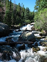
At the beginning of the month Ryan & Sarah Hall came through Colorado at the end of their nearly four-week west coast road trip from Chicago. On Sunday the 31st (of July) we went hiking in the Wild Basin area of Rocky Mountain National Park. The trail we took followed North Saint Vrain Creek past Copeland Falls, the Calypso Cascades, and Ouzel Falls. It was nice to hear running water and waterfalls through most of the hike!
 |
 |
And then the following night I joined them at Coors Field for the Phillies-Rockies game. It’s neat when you can see the mountains from your seat! We were one row below the “purple row” in the upper deck (row 20), which is at elevation 5,280 feet. There were a lot of Phillies fans at the game, and I even saw one girl with a green “State Patty’s Day” shirt on (ugh). Phillies fans were making themselves heard, by (of course) lustily booing every time the Rockies catcher went out to the mound to talk to the pitcher. It was an entertaining game too, but unfortunately for the Rockies, a Phillies pinch-hitter tied the game on a home run with two out in the top of the 9th, and then another home run in the 10th won it for the red-hot Phillies, 4-3. Anyway, it was great to see Ryan & Sarah again!
 |
 |
Mount Bierstadt – 14er #1
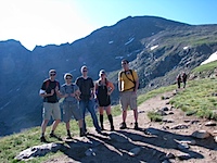
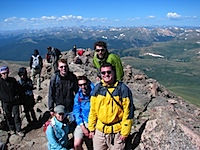
On Saturday the 6th I checked off an item from my “Colorado bucket list”: I hiked up a 14er! Five of us (me, Amy, Tim, Richard, Richard’s friend Anthony) got up really early in the morning to go hike Mt Bierstadt. Mt Bierstadt is rated as the easiest 14er to climb, but that doesn’t mean it’s an easy hike.
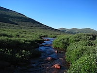
The hike started at Guanella Pass (11,669 feet), a few miles away from Georgetown, CO. The trail dips down about 200 feet to Scott Gomer Creek before rising all the rest of the way to the summit at 14,060 feet. I have to say it’s kind of annoying to start a hike up a 14er by going downhill for awhile — because that means the end of the hike is uphill as well. Anyway, I was trucking along until about 13,000 feet, when the trail became much steeper. I started lagging the rest of the way up to the top, but I made it!
 |
 |
 |
 |
It was pretty chilly up at the summit, about 40-45 degrees and quite windy. But the view from the top of Mt Bierstadt (14,060 feet) was spectacular! Here’s a video from the summit:
Here’s the view looking west (in the very center of the photo are two neighboring peaks, Grays Peak (14,270 feet) and Torreys Peak (14,267 feet)):

And here’s the view looking northeast, toward the nearby Mt Evans (14,264 feet):
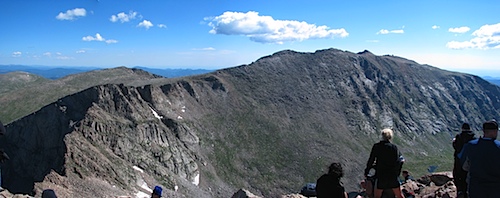
My first 14er! It was exhilarating!
 |
 |
Here’s a final look at Mt Bierstadt from the trailhead, at the conclusion of our hike (to the left of Mt Bierstadt is The Sawtooth, the narrow, exposed path over to Mt Evans):

Concert at Red Rocks
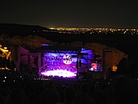
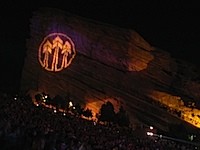
Another item on my Colorado bucket list was attending a concert at Red Rocks Amphitheatre just west of Denver. At the beginning of the summer I looked up their concert schedule, and had the 12th of August circled for a concert with The John Butler Trio. Unfortunately I couldn’t convince any friends to join me (concerts are expensive after all), so I wound up going by myself. I wanted to buy a ticket in advance, but Ticketmaster had an outrageous extortion fee — they were charging $55 for a $38.50 ticket. So instead I showed up at the box office on the day of the show, and got one for $40. Denying Ticketmaster their extortion fee is definitely a win.
At any rate, Red Rocks Amphitheatre is an amazing concert venue, sitting between Ship Rock and Creation Rock, with the city of Denver visible a few miles beyond the stage. It was a perfect Colorado evening too, with temps in the upper 70s and a full moon rising. The concert itself was pretty awesome too, and The John Butler Trio played for over two and a half hours! The concert obviously would’ve been more fun with some friends, but I still enjoyed it quite a bit. I left at the start of the final encore song so that I wouldn’t be trapped in the parking lot forever, especially since I had to wake up in a few short hours to go hiking.
 |
 |
 |
 |
Grays & Torreys Peaks (14ers #2 and #3)
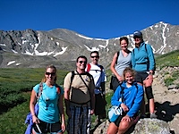
After three hours of sleep following the concert at Red Rocks (which included five hours of sitting on a bench without a seat-back), it was time to wake up to go climb two 14ers! This time it was me, Richard, Amy, and three of the Moxness sisters (Adelle, Melanie, and Mikaela), all friends from church.
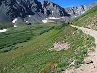
First off, the road from I-70 up to the Grays Peak trailhead is TERRIBLE. I’d really only advise going up there with a 4WD vehicle. Even so, you can only go about 3 mph because it’s so ridiculously bumpy and unmaintained. Partway up the narrow, steep road we saw a bunch of cars parked along the side, so figured we’d better park too. A guy even said, “Oh yeah, the trailhead’s right here.” So we got out our stuff and started hiking up the steep road. A mile and a half later we finally came to the trailhead. Ugh. I think we might’ve done 800-1000 feet of climb in that 1.5 miles. I’m tellin’ ya, that road was relentlessly steep. And oh yeah, there was still some parking at the lot at the trailhead. So we were already a bit tired by the time we got to the actual start of the trail at 11,280 feet.
 |
 |
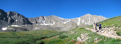
A bit over a mile into the hike, at elevation 12,100 feet, here’s a view of Grays Peak (14,270 feet, on the left) and Torreys Peak (14,267 feet, on the right). It looks like Torreys is taller, but it’s not. Grays Peak also happens to be the tallest peak along the Continental Divide, and the tallest in the Front Range.
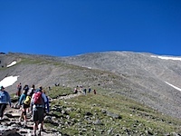
The hike to the top of Grays and Torryes was noticeably more arduous than the hike up Mt Bierstadt, but it’s still among the easier 14er hikes, apparently. It’s just a longer, steeper hike than Bierstadt. There are also so many switchbacks on the trail to Grays that it often feels like you aren’t making progress. Anyway, I was doing well setting the pace until around 13,000 feet again, when I started lagging a bit at the back of the group, just like on Bierstadt. But after a break I decided to take the lead again, and I didn’t have exhaustion problems the rest of the way up, surprisingly. The mind is pretty powerful, even when it’s oxygen-deprived. 🙂 And on the way up Grays Peak I even ran into a fellow Penn State Meteorology alum, Beth R.! We Are… everywhere! At last we made it to the top of Grays!
 |
 |
Below is a view from Grays Peak, looking west (toward Keystone Ski Resort, Silverthorne, Lake Dillon):

Below is a view from Grays Peak, looking north. From L to R: Torreys Peak (14,267 feet), Kelso Mountain (13,100-something), and Stevens Gulch. Our trail came up Stevens Gulch, winding around Kelso Mountain before scaling Grays.

Below is a view from Grays Peak, looking east. In the center of the photo are two 14ers, Mt Evans (14,264 feet, on the left), and Mt Bierstadt (14,060 feet, on the right).

Grays Peak was my second 14er, and I was feeling pretty good!
 |
 |
 |
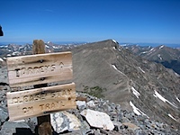 |
After a lunch break, it was time to head down to the Grays-Torreys saddle (13,700 feet), and then climb straight up Torreys. It was steep, and brutal after having taken a break atop Grays. My body did not like going back uphill at this point, especially such a steep hill, and I struggled making it up Torreys. But I did make it, and that wasn’t ever in question.
 |
 |
Here’s a view from Torreys Peak, southeast toward Mt Evans, Mt Bierstadt, and Grays Peak (notice all the switchbacks on Grays!):
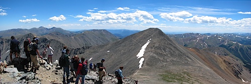
14er number three, and the second of the day!
 |
 |
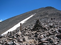
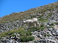
I ran out of water before I made it to the top of Torreys Peak (I had 3 liters in my Camelbak), leaving me with about 2/3 of a liter of Powerade to ration on the 3.5-hr hike back down. Highlights of the way down: several snowballs suddenly whizzing by my head, mountain goats, wishing my legs weren’t horribly sunburned (I forgot to put sunscreen on them, sigh), and putting on flip-flops when we were finally done.
 |
 |
 |
 |
 |
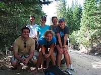 |
Approx. 12 miles, approx. 4500 feet elevation gain, approx. 10.5 hours, and two 14ers conquered. We were all exhausted and sore, but felt very accomplished!

3 Responses to August Adventures